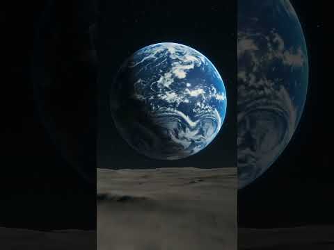
Okay, so picture this: you’re sitting in your room, scrolling through your phone. Suddenly, you stumble upon these stunning images of Earth from space. Seriously, it’s like the planet’s Instagram feed!
But here’s the kicker: those vibrant snapshots aren’t just for eye candy. They’re from NASA’s Earth View project, giving us a peek into our planet’s story. It’s wild to think that all those colors and patterns you see up there are tied to real stuff happening down here.
You might be asking, what’s the deal with it? Well, it’s all about understanding our world better. From climate change to natural disasters—these images show us what’s going on in a way that numbers and graphs just can’t.
So let’s chat about how NASA is literally giving us a window into our planet’s science and why you should totally care!
Exploring the Cosmos: Did NASA Transmit Photographs to Extraterrestrial Life?
You know, the idea that we might send photos of Earth to aliens is pretty mind-blowing. I mean, imagine sitting at home and suddenly realizing there could be extraterrestrial life out there, peeking at our planet through images sent by NASA! Let’s break this down.
First off, NASA has been on a mission to explore the cosmos and learn about potential life beyond our little blue planet. Over the years, they’ve sent spacecraft into space to gather data and take stunning photographs of not just Earth but other planets too. But did they actually send images of Earth specifically for aliens? Well, kind of!
One of the most famous examples is the Golden Record. Launched aboard the Voyager spacecraft in 1977, it contains messages from Earth that include sounds, music, and yes—images! The thought behind it was simple: if any intelligent beings out there happened to find Voyager in space someday, they’d get a glimpse of who we are.
Now let’s think about these images for a second. They depict a variety of aspects from our planet—like landscapes, people from different cultures, animals—you name it! So it’s like sending a postcard but much cooler since it’s aimed at potential alien neighbors.
But here’s where it gets tricky. You might wonder: will they even understand what they’re looking at? The truth is, we have no idea what kind of technology or species might intercept those signals. The way aliens perceive images could be totally different than us humans do.
Also, there’s something called the Fermi Paradox, which raises more questions than it answers. It basically asks why we haven’t found evidence of extraterrestrial life despite the vastness of space and our attempts to reach out to them. Sending pictures is one way to try and connect with those distant beings—if they’re out there.
And then you have to consider how far these signals travel! Light from Earth takes years to reach other star systems; some are thousands or millions of light-years away. So any image we transmit now will take an eternity before anyone—or anything—sees it!
You might also be curious about how often this happens. Well, while sending images isn’t super common after Voyager’s Golden Record or some specific projects like SETI (Search for Extraterrestrial Intelligence), scientists are still looking for ways to communicate across the cosmos through radio waves and other methods.
In summary:
- Nasa’s ventures: They’ve launched spacecraft like Voyager with messages intended for potential extraterrestrials.
- The Golden Record: A collection of sounds and images designed as a cosmic greeting.
- Understanding communication: It’s uncertain if aliens could interpret those images in any meaningful way.
- Distant travels: Signals take eons to reach other worlds!
So yeah, while NASA has made efforts in sending representations of humanity into space hoping for a reply someday (who knows?), it’s still more complicated than just clicking “send” on your phone! Who knows what lies beyond? What an adventure that would be if we ever got a postcard back!
Exploring NASA Worldview: Is Access to Satellite Imagery Free for Scientific Research?
NASA Worldview is a pretty neat tool. It’s like having your own satellite spy, but for the planet! You can check out images of Earth from space, and the best part? It’s free for everyone, including scientists and researchers.
Basically, NASA provides access to a vast collection of satellite imagery. You can see everything from cloud patterns to wildfires, and even how glaciers change over time. It’s all there at your fingertips. Imagine sitting on your couch, scrolling through high-resolution images of the Amazon rainforest or icebergs in Antarctica. Fascinating stuff!
Now, let’s talk about how this works for research. Scientists often need accurate data to study climate change, natural disasters, or urban development. With NASA Worldview, they can easily download images that are updated regularly. This means they get the most current information available.
Here are some key points to consider:
- Access: You don’t have to pay a dime! Just hop onto their website and start exploring.
- User-friendly: The interface is designed to be simple. You can zoom in and out and even overlay different data layers.
- Real-time data: Many images are updated daily. If there’s a hurricane brewing or a wildfire spreading, you’ll see it almost immediately.
One cool aspect is how NASA encourages public involvement in science through these tools. Anyone can use Worldview for educational projects or personal curiosity—like tracking changes in their hometown!
When I first stumbled upon NASA Worldview, I spent hours comparing satellite images of my childhood neighborhood with current ones. It was incredible! I could see how much it had changed over the years — new parks where there used to be lots, roads where fields were once growing crops—made me think about how we impact our environment.
In summary, yes! Accessing satellite imagery through NASA Worldview is completely free and open for scientific research purposes too. This tool not only helps scientists but also lets anyone interested explore our planet from an amazing perspective. So whether you’re a seasoned researcher or just a curious mind like me, you’ve got all this incredible data waiting for you online!
The Significance of Apollo 17’s Iconic Earth Photograph in Science and Space Exploration
So, let’s chat about that famous photograph taken during Apollo 17. You know, the one that shows Earth from space? It’s often called “The Blue Marble.” Seriously, it’s one of the most iconic images ever snapped! But what’s the big deal about it in terms of science and space exploration? Buckle up, and let me walk you through it.
First off, this photo was taken in December 1972. Apollo 17 was the last manned mission to the Moon, and while astronauts were busy exploring lunar science, they captured this stunning view of our planet from about 29,000 kilometers away. It’s really something to see—Earth looks like a blue-and-white marble floating in the dark expanse of space.
One major significance of this photograph is its role in raising awareness about our planet. Before Apollo 17, most people had never seen Earth from that perspective. The image sparked interest in environmental issues because it highlighted how fragile our world looks when viewed from afar. Seeing our home like that made folks realize just how interconnected we all are.
Another cool thing is how this image contributed to science. It became a crucial tool for studying Earth’s atmosphere and climate patterns. Scientists used it to observe weather systems and track changes over time, which is super important for understanding climate change today.
And let’s not forget about inspiration! That photo fired up imaginations everywhere. It became a symbol for peace and unity; doesn’t it feel like a reminder that borders vanish when you see Earth from space? Lots of artists and movements have drawn inspiration from it since then.
The technology used to capture this photograph was groundbreaking for its time too! The camera system on Apollo 17 helped push forward advancements in both photography and imaging technology, which we still benefit from today in fields like meteorology.
In addition to all this, The Blue Marble also serves as a reminder of our shared responsibility for taking care of our planet. After all, there’s no backup Earth floating around out there! The image continues to resonate with people today—like when you see it used by environmental organizations or even social media posts encouraging sustainability.
Finally, I think it’s fascinating how something as simple as a photograph can carry so much weight. It encapsulates human curiosity and exploration spirit while reminding us where we come from: one small blue planet among countless stars. So yeah, next time you look at that iconic image of Earth, think about all the extra layers it has beyond just being visually stunning—it’s literally a snapshot of our history with significant implications for science and society alike!
You know, sometimes I find myself just staring at pictures of Earth from space. There’s something about those images that really hits you deep, like a reminder of our little blue planet just hanging in the vastness of the universe. NASA’s Earth View is like a front-row seat to this incredible show. It’s not just stunning visuals; it’s a powerful glimpse into what makes our world tick.
I remember the first time I saw one of those breathtaking images — a photograph of swirling clouds over the ocean. It made me stop and think about how interconnected everything is. Seriously, all those tiny patterns and formations are part of larger systems that affect weather, climate, and even our daily lives. Those shots from NASA help scientists track changes in the atmosphere, monitor natural disasters, and understand climate change in real-time. Kind of mind-blowing when you think about it!
NASA uses satellites equipped with serious tech to gather data on things like temperature variations, ocean currents, and even deforestation. Imagine being able to see the effects of human activity from space! It’s a stark reminder that while we’re busy living our day-to-day lives, there are bigger forces at play that can impact us all.
The thing is, these images evoke emotions too. They remind us of beauty but also urgency. Like when I saw satellite images showing shrinking ice caps or deforestation in places like the Amazon. Those moments hit hard because they show what could be lost if we don’t take care of our planet.
And it’s not just for scientists; anyone can use tools like NASA’s Earth View to explore and appreciate our home from above. You can literally zoom into your neighborhood or watch how wildfires spread in real-time — it drives home how small we really are but also how powerful our impact can be.
So yeah, while some might see these images as just pretty pictures or data points on a graph, they’re so much more than that. They offer us insight into Earth’s systems and remind us that we have this responsibility to protect what we have left. It’s pretty overwhelming at times but also inspiring — knowing that we’re all part of this larger story together.